Arequipa
26th March - 4th April 2025
Ruta De Sillar
Another overnight Peru Hop coach later took us from Puno to the white city, Arequipa. Enroute, late in the evening the company required us to make an unscheduled transfer of coaches, and whilst not a major inconvenience they offered a free tour the following day in exchange as a goodwill gesture. The arches and scenic view point of Yanahuara, adjacent to the Parroquia San Juan Bautista de Yanahuara church was our first stop. This offered framed views over the city to the iconic cone volcano of Misti. A seed may have been planted this morning…
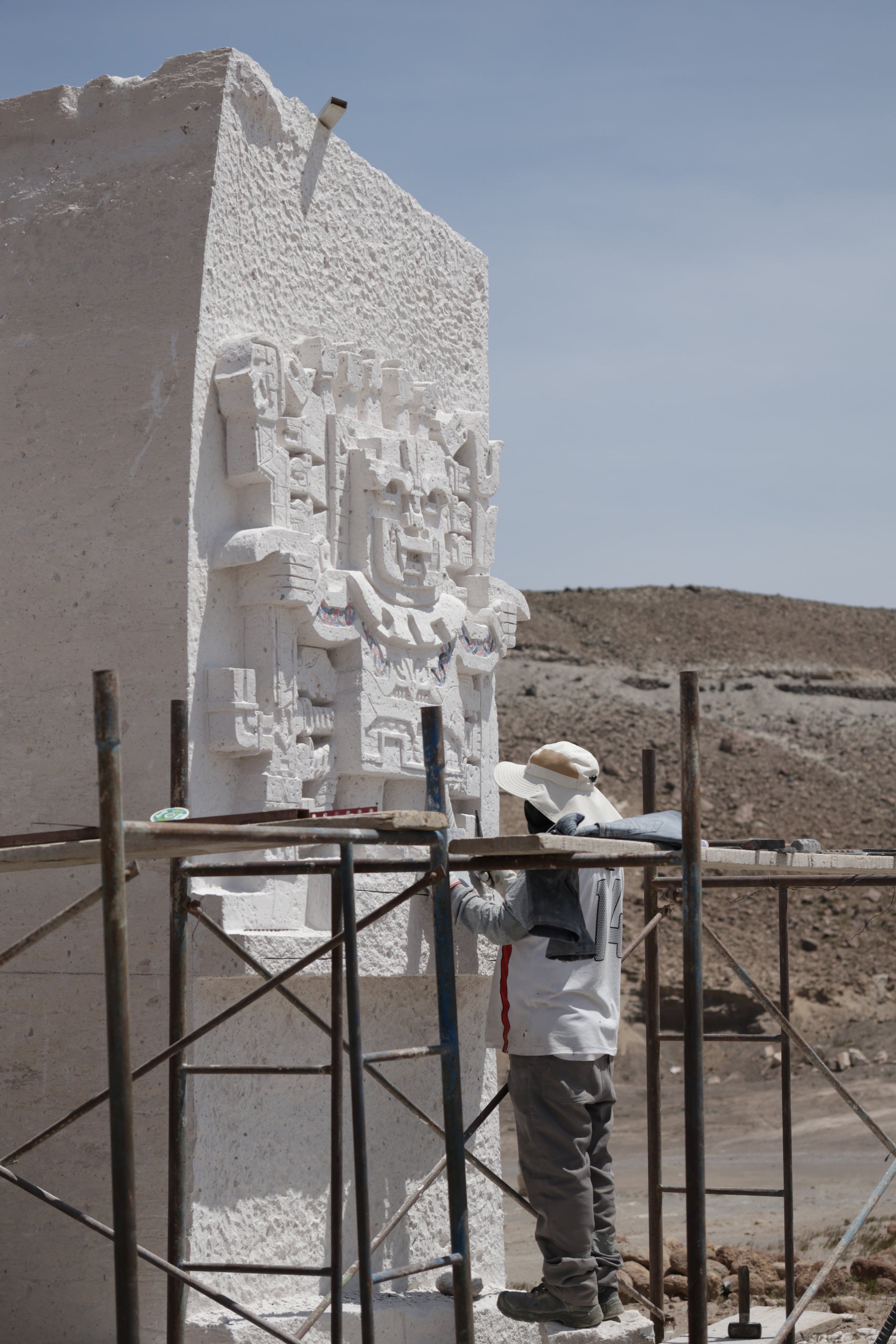
Half an hour later on the bus, we arrive at the open cast mines in the volcanic plains on the outskirts of the city. Sillar stone formed from volcanic eruptions, is famed for its white colour and has been mined in this region for hundreds of years, used to construct much of Arequipa’s historic district, giving its distinctive architectural appearance. The stone is comparably soft and easy to carve into ornate forms and still to this day is quarried using manual labour and basic hand tools without extensive mechanical assistance. Driven further across the volcanic landscape we arrive at the trail head to a natural canyon known as Quebrada de Culebrillas. The canyon's water formed landscape was enthralling alone, but before we left the canyon the they were levelled up by the petroglyphs carved into the rock faces. These were left by the Wari people over 1000 years ago, and have drawn the attention of many since, with the construction of stone towers called Apachetas.


The White City
Arequipa is a showcase of Spanish colonial architecture, featuring sillar stone structures with intricate stone carvings. Many of the baroque style structures were severely damaged or destroyed in the 2001 8.4 magnitude Southern Peru earthquake, before being meticulously restored.


Salinas Lagoon
Clambering into another minibus, we head towards the valley formed between the volcanoes of Misti and Pichu Pichu. The landscape is staggering and the road is precariously hewn into the mountainside. It is peppered with small shrines to those who have tragically left its sheer edges. Winding along a snaking road we pass through the privative túnel chiguata before the elevation begins to plateau and we approach the salt flats, locally called the Salinas. The bus pulls over and we have the opportunity to see wild Vicuna intermingling with their domesticated cousins, Llamas and Alpacas. These camelids are more slender in build, and keep a more wary distance from us whilst drinking from the salt flat lake. To get further into the salt flats and experience this surreal landscape, we rent quadbikes and ride out into the giant mirror.


Peruvian Cooking
Whilst in the city, we took the opportunity of a cooking class. Two local Peruvian dishes were prepared, Causa, a mashed potato based starter and Lomo Saltado, a fiery and fun stir fry cooking experience!


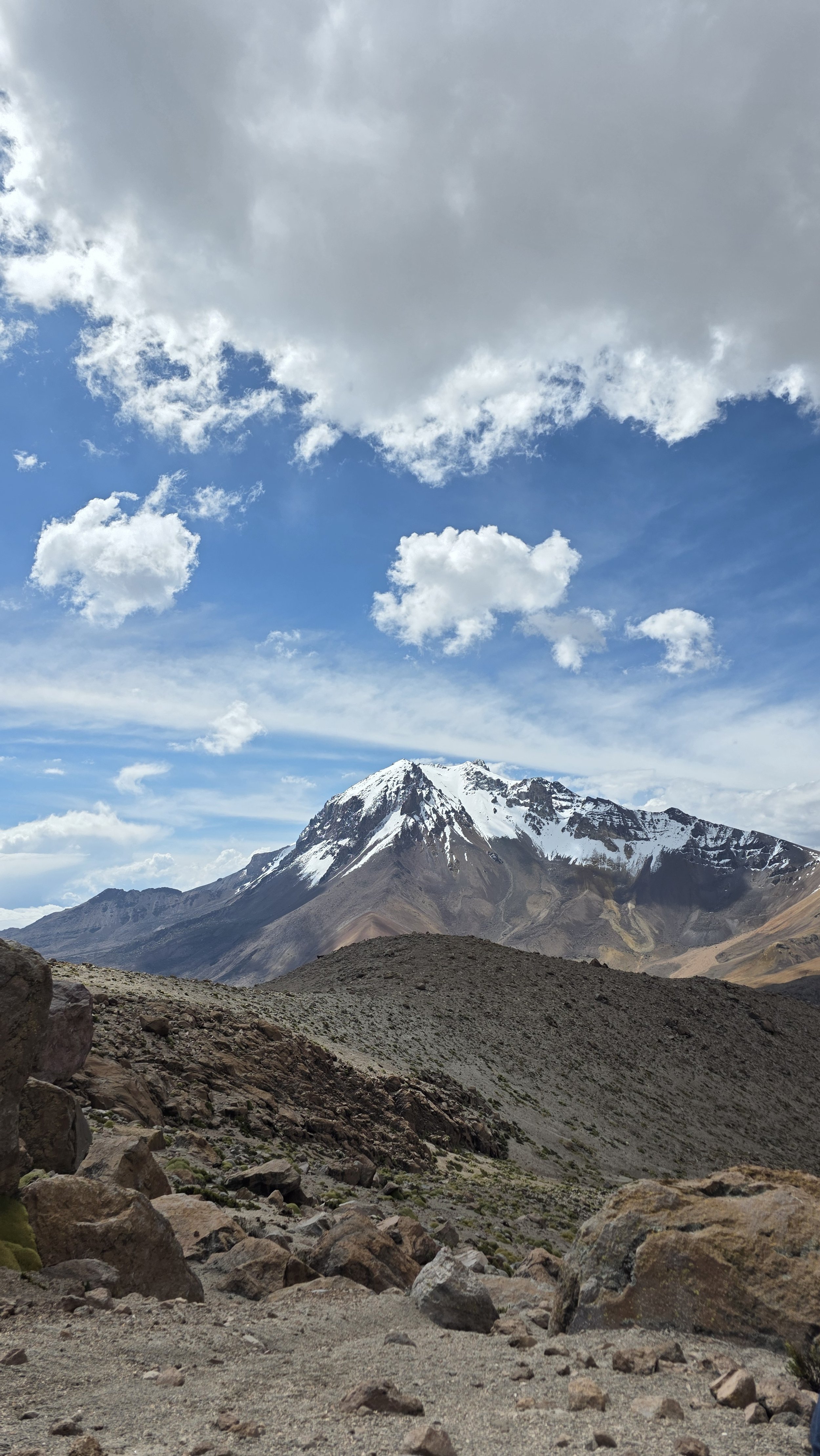
Volcan Chachani
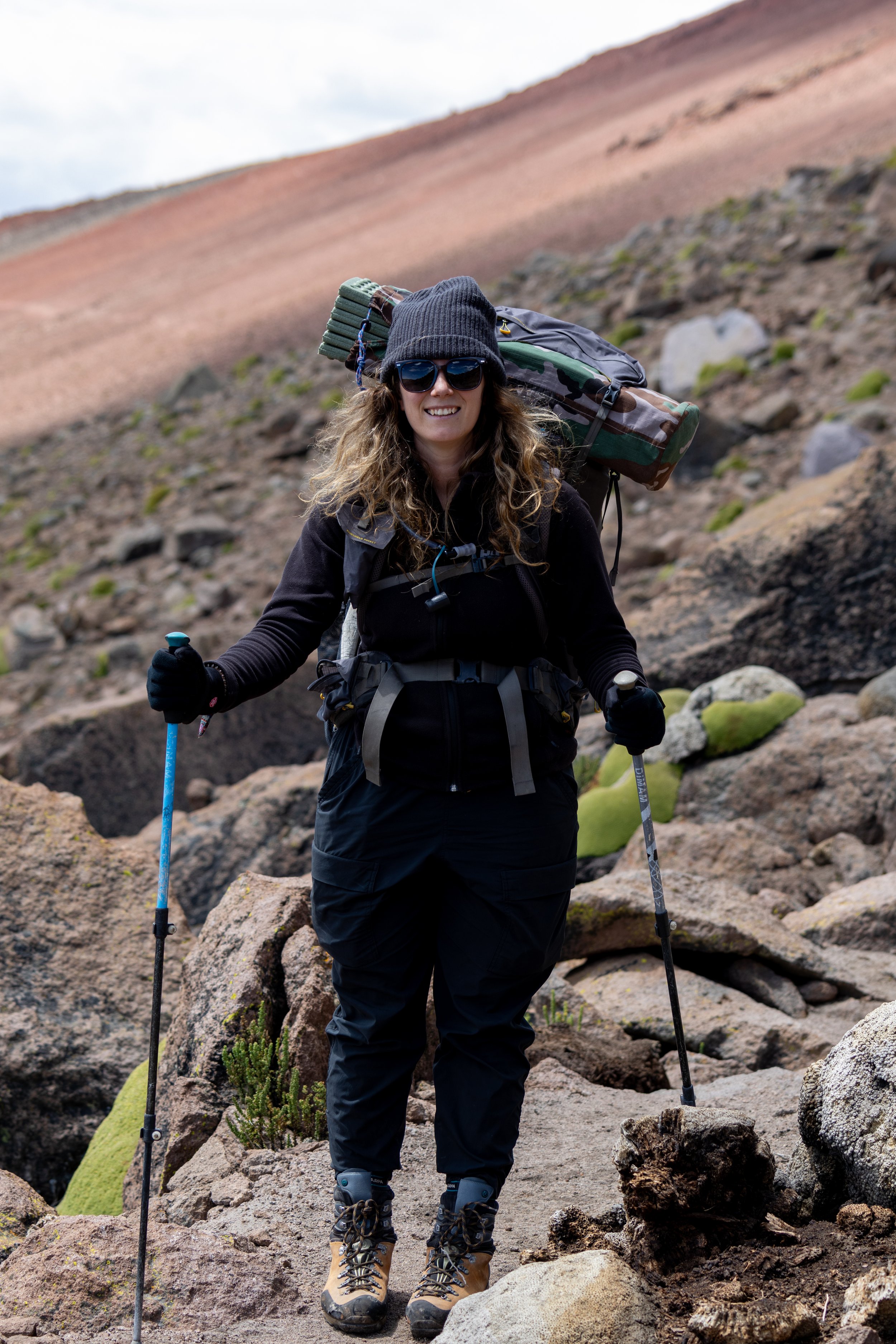
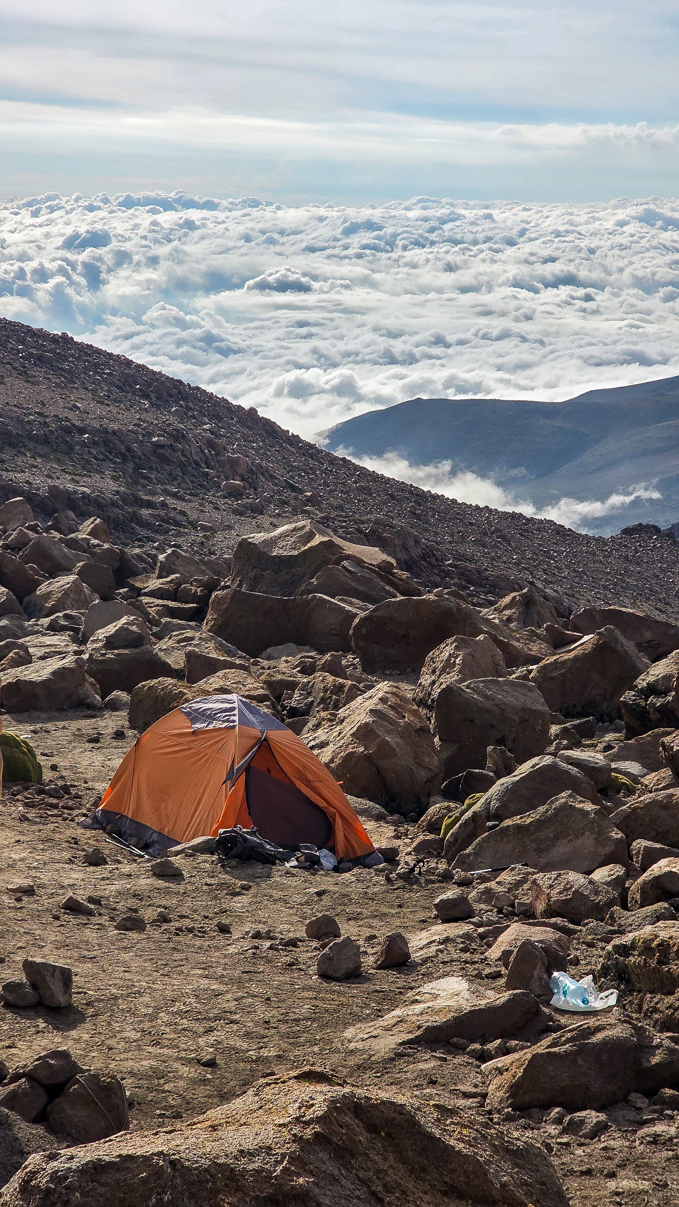
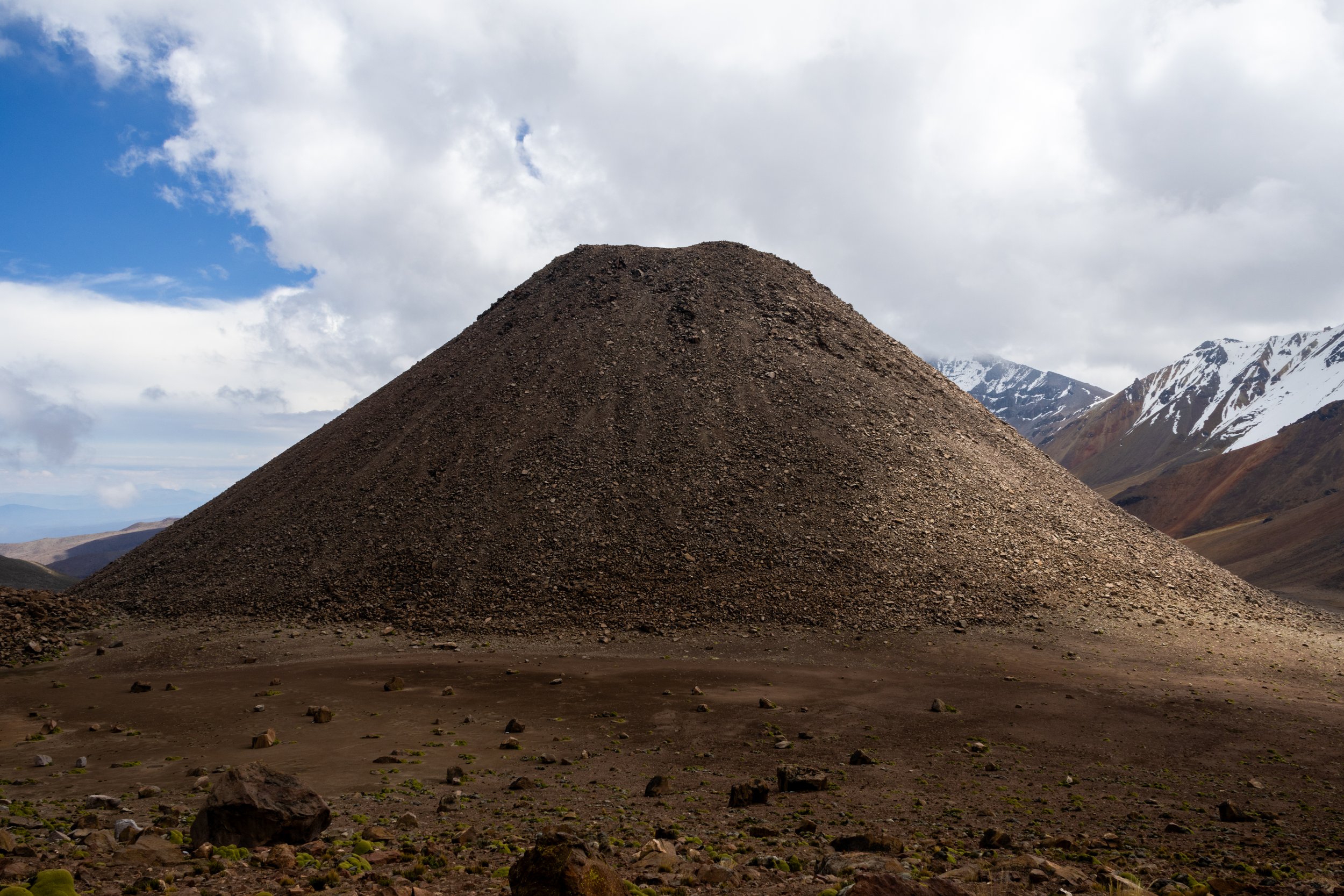
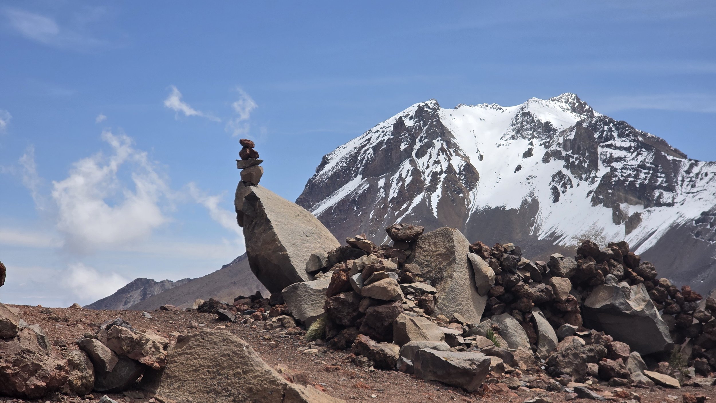
Having spent time in Arequipa with the backdrop of towering Volcano’s Misti and Chachani, the temptation to climb one grew too great to resist. We opted for Chachani, with a summit of 6,057m. Our highest elevation to date had been 4,701m when trekking through the Condor Pass, so this was going to be a significant step up. To get to the trail head required a ride in a jacked up Land Cruiser, a drive of over 3 hours from the city with a driver, our guide and two other trekkers. Unfortunately Ben was still under the weather and opted to sit this trek out. Arriving adjacent to the crater, we said goodbye to our driver, mounted our large rucksacks and began the trek to basecamp. The air felt thinner than ever before, and the scenery was equally breathtaking. Chachani's last eruption is estimated at over 10,000 years ago, and is considered dormant, but due to the proximity to Arequipa, scientist continue to monitor the volcano for any new activity. The crater was vast and boulder strewn, making our progress slow but steady. The basic trail is surrounded by Yerata plants which exclusively grow at altitudes between 3,200 and 5,250m. To touch they feel as hard as the surrounding rocks. Arriving at base camp we pitch our tents and weigh them down with rocks, in anticipation of a short nights sleep, as we will start the hike at 1am.
Sleep I did not, I merely could close my eyes and try. Hearing one of our fellow hikers waking and gasping for air, before clambering from their tent to be sick was a stark reminder this was a hostile environment and not to be diced with. Thankfully I was only faced with a bad headache when we began to clamber from our tents at midnight. It was old, very cold and the inside of the tent had a thin layer of ice where condensation form our breath had frozen. Wearing two pairs of socks, thermals, multiple midlayers, insulated snowboarding type trousers and a thick insulated down jacket, and two pairs of gloves we say goodbye to our fellow trekkers who have opted to bail out of the trek and stay at base camp. Soon the scree slope becomes too steep to climb directly and we begin a switch back route zig zagging across the mountainside. We are moving only by torchlight and pause on each hour to rest, catch our breath and let our heart rates reduce before slowly trudging on. 3 hours in, we stop to don crampons, as the trail turns to snow cover. The pace slows further on this surface, and Alex is feeling increasingly unwell with altitude sickness, the thin air makes our rest breaks more frequent. My watch reads 5,660m, heroically, Alex says she wants to make 5,700m for sunrise where we can take stock. The warm colour of sunrise pierces the cold and we drink in the vistas from these new heights. In pausing, the cold really sets in and we make the tough decision that this is as high as we’ll go today. In daylight the going is still tough, but we take some comfort in knowing every step downhill the air will be that be thicker and our altitude sickness symptoms would hopefully alleviate.

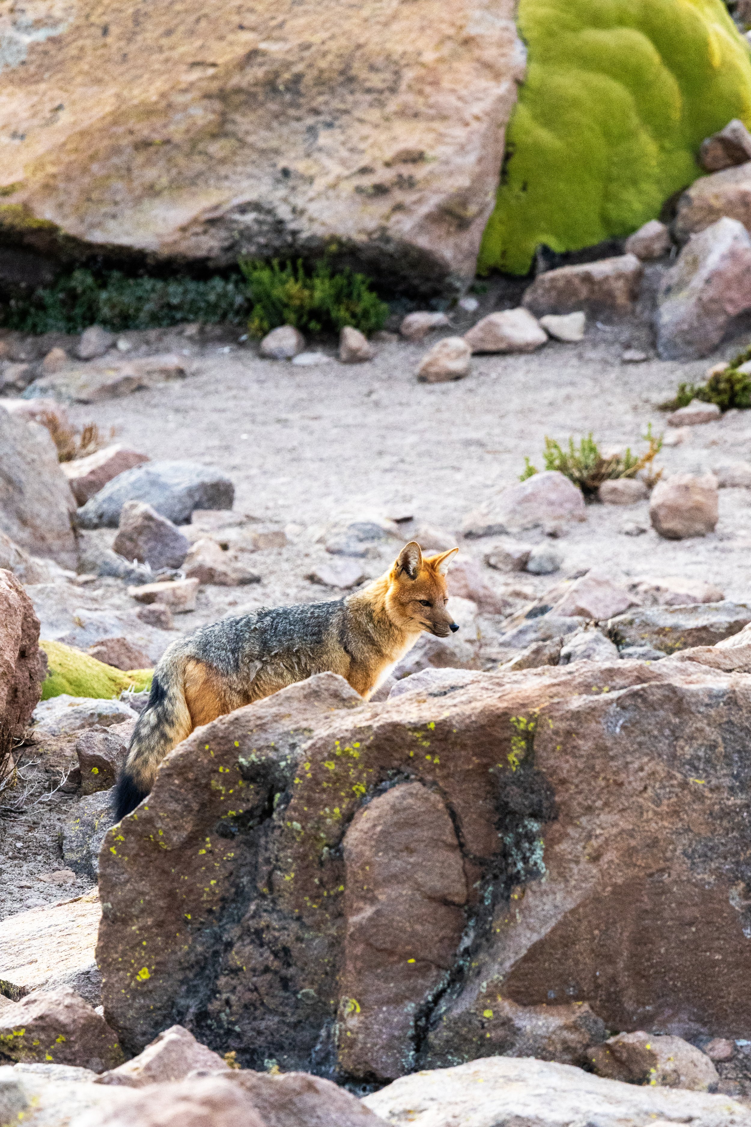


Our guide upon hearing our decision says he must inform the office to summon the 4x4 to collect us sooner than scheduled. Somewhat surprisingly he wasn’t carrying a sat phone, but here his experience liivng at altitude and as a high altitude guide really showed. They dropped their bag and explains they will chase after another trekking group ahead of us, they are likely a hour ahead at the pace we were moving and passed over a false summit more than half an hour ago. They disappear at a tremendous pace and continue steadily down the snowy slopes. Up at this altitude we see yet more special wildlife, including an Andean Fox and Southern Vicacha who make navigating this terrain appear effortless.


Next the Nazca lines and a reunion in the desert…


Falling for another sport beginning with s…